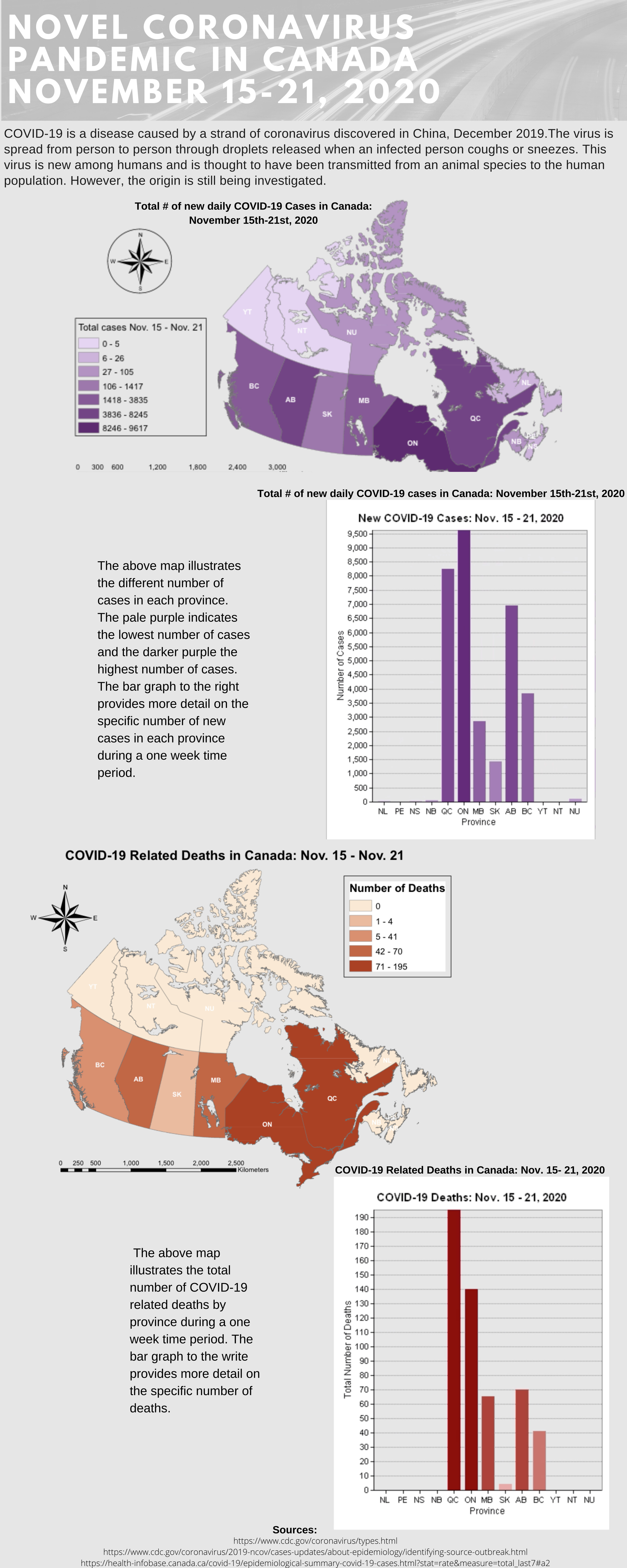
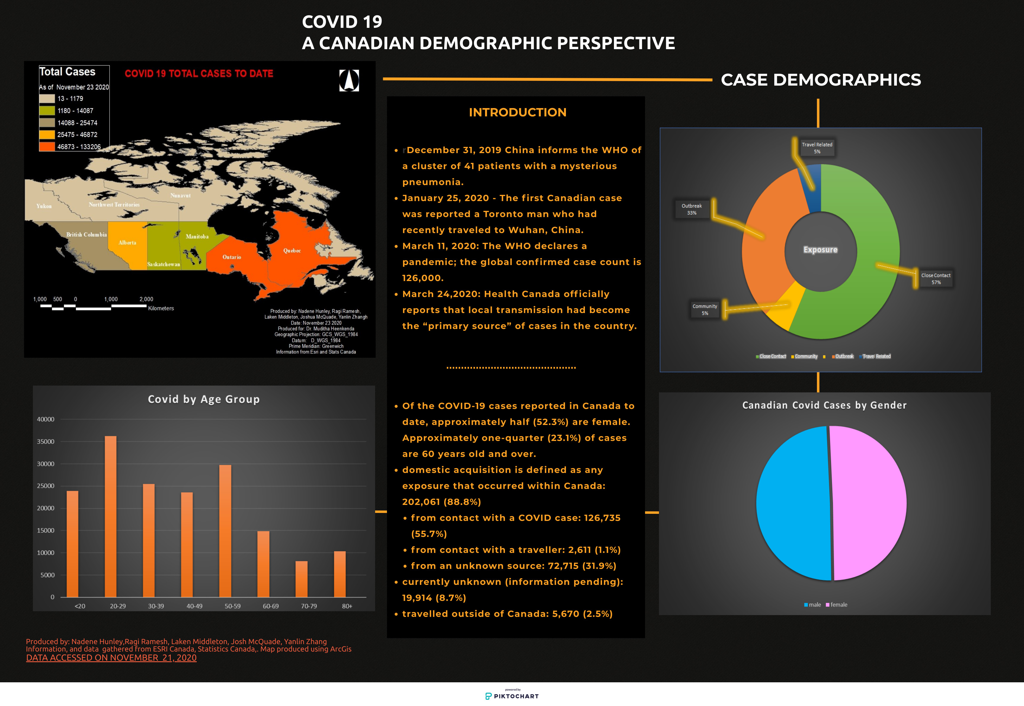
COVID-19 Infographics
The Fall 2020 Intro to Geomatics and GIS (Geog2232) class created infographics to explore the impact of COVID-19 in Canada. Various geovisualization techniques were employed to track the progress of the pandemic in Canada, compare jurisdictions and assess the difference between the first and second wave of infections in the country.